 |
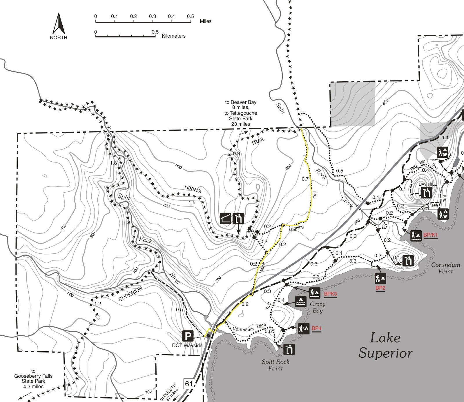
| Map of Merrill Logging Trail. |
Route heads through Split Rock state park
Day hikers can travel into the bluffs overlooking Lake Superior via a century-old railroad grade at Minnesota’s Split Rock Lighthouse State Park.
The Merrill Logging Trail, including an access trail from Split Rock River, runs 2.7-miles round trip. It crosses an area that many visiting the state rock bypass in favor of the historic lighthouse.
To reach the trailhead, from Two Harbors travel north on Minn. Hwy. 61. Park at the DOT Wayside for Split Rock River. From the lot, go north on walking path and take an immediate left/north onto the access trail for the Gitchi-Gami State Trail; this stem runs under the highway.
Once at the main trail, go left/northeast onto it. Follow it for 0.25 miles, then turn left/north onto the Merrill Logging Trail. A crossing of Hwy. 61 is required here, so be careful, as the road is busy.
Merrill Grade
Once across the highway, the grassy trail angles to the northeast into the woodline and climbs the Merrill Grade. Though steep, gaining about 150 feet in 1.1 miles, it is the easiest way to head up the bluffside.
From 1899 to 1906, the Merrill & Ring Lumber Company ran a logging camp at the mouth of the Split Rock River. A rail line headed 10 miles into the bluffs and backcountry, hauling timber to the river mouth. The trail follows a segment of that rail line.
About 0.2 miles from the Gitchi-Gami, the Merrill route reaches its first trail junction, a connector to the Superior Hiking Trail. Continue straight/northeast.
During the 1860s, Thomas Merrill – the product of a Maine lumber family – started a number of logging companies in Michigan. In 1886, he joined forces with Clark Ring, and they based their company out of Saginaw, Mich.
Split Rock Creek
In another 0.2 miles, the walking path junctions another connector to the Superior Hiking Trail. Go right/east here and continue up the bluff. In short order, the trail angles north.
As the white pine forests of the Great Lakes states thinned in the 1890s, Merrill & Ring purchased land in Washington state. In 1902, they moved their headquarters there.
About 0.7 miles from the last junction, the Merrill Logging Trail intersects the Superior Hiking Trail at Split Rock Creek. The creek rises from even higher in the bluffs, at an elevation more than 200 feet above this point.
The creek marks the park's northern boundary and the end of the Merrill Logging Trail. Turn back here, retracing your steps back to the wayside parking lot.
Learn about nearby hiking trails in Day Hiking Trails of Split Rock Lighthouse State Park.
